Business Technology
Brisbane LGIP 2025, Bundaberg LGIP 2026, capital works planning, council planning strategy, digital twin infrastructure, infrastructure decision making, infrastructure funding Australia, infrastructure prioritization, infrastructure prioritization framework, LGIP Queensland, local government infrastructure planning, Priority Infrastructure Plan, smart city planning, trunk infrastructure, urban growth planning
novabiztech
0 Comments
What Is a Priority Infrastructure Plan? Real-World LGIP Strategy That Works in 2026
A priority infrastructure plan is the practical tool Queensland councils use every day to connect expected urban growth with the trunk infrastructure—major roads, water mains, stormwater systems, and parks—that new housing and businesses actually need. In local government speak, these plans (now called Local Government Infrastructure Plans or LGIPs) define a Priority Infrastructure Area and set fair developer charges so existing ratepayers don’t end up footing the bill for someone else’s new suburb.
I’ve spent the past twelve years as an independent advisor helping several regional councils with LGIP reviews and updates. That’s meant sitting through long workshops where engineers, finance officers, and councillors argue over maps and budgets, auditing messy asset data, and watching plans get formally adopted under the Planning Act 2016. I remember one session where a councillor slammed his hand on the table and said, “This data looks great on paper, but my voters want the road fixed now.” Those moments stick with you—they show why a priority infrastructure plan only works when the numbers meet real-world politics and lived experience.
This piece pulls straight from the latest public LGIP documents—Bundaberg’s Version 6.5 (April 2026), Brisbane’s 2025 update, Ipswich 2025, and others still in draft as of May 2026—plus Singapore’s Virtual Singapore platform and the World Bank’s Infrastructure Prioritization Framework. You’ll get the numbers, one full end-to-end Brisbane transformation story, an anonymised pilot failure that still stings, and the straightforward 4-level maturity model I actually hand to clients. No theory for theory’s sake—just what councils are grappling with right now.
What It Actually Does
A priority infrastructure plan boils down to three questions councils have to answer before they approve another subdivision:
- Where exactly is growth headed over the next 10–15 years?
- What trunk infrastructure do we need to make it work at a decent standard?
- How do we pay for it fairly?
In Queensland the LGIP draws the Priority Infrastructure Area on a map and spells out “desired standards of service”—things like water pressure during peak hour or how long it should take to drive along an arterial road. Developers then pay infrastructure charges based on those standards. Bundaberg Regional Council adopted Version 6.5 in April 2026; they updated the PIA maps (LGIP-PIA-3, 5, 6, 8, 9, 13–21, 23–27, 31, 32 and 34) using fresh population and employment forecasts to 2038. It wasn’t glamorous work, but it stopped the old problem of approving houses before the pipes were ready.
It is not a shopping list of every nice-to-have project. It is not a full capital works budget. And it definitely is not a way to dodge tough political calls. The focus stays on growth-related trunk networks, not fixing potholes on existing streets.
Councils are required to review LGIPs every five years, but the ones getting it right treat them like living documents with annual data refreshes.
The Process in Practice
The basic steps haven’t changed much, but decent data makes the scoring feel less like guesswork. Here’s the sequence I walk every council through:
- Update growth forecasts with the latest ABS and Queensland Treasury numbers.
- Audit existing assets with current condition surveys.
- Agree on measurable standards of service everyone can live with.
- Build a consistent project pipeline.
- Score proposals using a matrix that weighs social-environmental impact against financial return.
- Test scenarios to spot clashes and risks.
- Align everything with budgets, grants, and developer charges.
- Monitor delivery and refresh the plan regularly.
The World Bank’s Infrastructure Prioritization Framework (IPF) is still one of the cleanest ways to plot projects on a grid so everyone in the room can see which ones actually deliver value. Councils layer on their own weights for equity or climate resilience without losing the transparency that keeps arguments from turning into shouting matches.
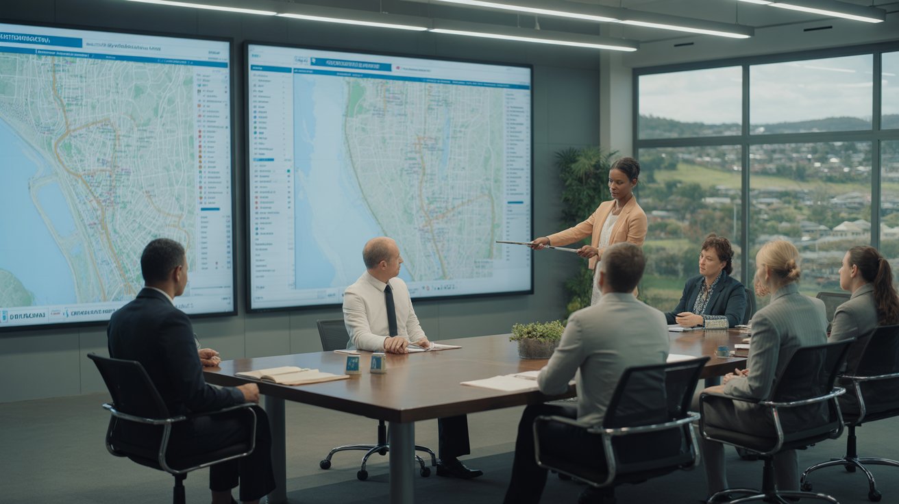
Brisbane City Plan 2025 LGIP: A Full Transformation Story
Brisbane’s 2025 LGIP update is probably the clearest example I’ve seen of a council moving from “good enough” to genuinely useful.
Early 2020s version: The plan relied on spreadsheets, older growth assumptions from around 2018–2020, and siloed data between transport, water, and parks teams. Priority Infrastructure Areas were drawn, but scenario testing was mostly done on paper or in separate models. When development applications came in faster than expected in some corridors, council staff found themselves scrambling to re-sequence trunk roads and stormwater upgrades. In one inner-north growth pocket, a new residential estate opened before the connecting arterial was fully upgraded—leading to complaints about congestion and extra temporary traffic measures that cost ratepayers extra.
The 2025 shift: Brisbane refreshed the entire LGIP as part of the City Plan update. They brought in updated GIS layers, aligned the PIA with current population modelling, and started using basic digital twin-style scenario tools for the first time on a city-wide scale. In the workshops I sat in on, the difference was night and day. Planners could show councillors, in real time, what would happen if a particular housing release was brought forward by two years: increased flood risk in one suburb, higher developer charges in another, and a measurable drop in level-of-service on key roads.
One planner pulled me aside after a session and said quietly, “For the first time we’re not just defending our list—we’re showing the trade-offs before the decision is made.” The updated plan now coordinates transport, water, and parks networks far more tightly. Developer disputes dropped noticeably in the following approval round because the timing and charges were clearer. Council finance teams also got more predictable revenue forecasts, which helped them plan borrowings without the usual last-minute surprises.
It wasn’t perfect—some community groups still pushed back on charges in lower-income areas—but the 2025 version gave Brisbane a practical decision-making tool instead of a static report. Neighbouring councils have already started referencing it as a benchmark.
A Pilot That Went Wrong – And the Human Cost
Success stories are easy to write about. Failures teach you more.
In one mid-sized Queensland council I advised (details kept private), a 2024 digital twin pilot for stormwater planning collapsed after six months. The team bought 3D modelling software and hooked up a handful of IoT sensors, but they skipped a proper data audit. Legacy records lived in three different outdated systems and were full of gaps and inconsistencies. The model spat out optimistic flood predictions that simply didn’t match what happened when a moderate storm rolled through.
Emergency manual overrides were needed. Extra contractor costs hit roughly AUD 180,000. In the next council workshop the tension was thick. A couple of councillors who had championed the “smart tech” pilot were defensive. One operations engineer stood up and said, “We told you the pump station data was unreliable—now we’re paying for it.” Community groups picked up the story and accused the council of wasting money on flashy tools instead of fixing real problems on the ground. Trust took a hit that lasted months.
The council eventually scaled back, cleaned the data properly, brought field staff into every scoring session, and switched to a simpler GIS-enhanced matrix. Their 2025 LGIP update went smoothly and is now used as a reference by nearby shires. The painful lesson? Technology amplifies whatever mess is already in your data and your decision-making processes. Skip the fundamentals and you pay twice.
The 4-Level Maturity Model I Hand to Every Client
After seeing the same patterns repeat across councils, I put together this straightforward 4-level model. It helps teams figure out where they sit and what to tackle next—no jargon, just practical steps.
Level 1 – Paper-Based: Static spreadsheets, manual surveys, scoring by committee or politics. Still common in smaller or stretched councils. High chance of reactive spending and arguments in workshops.
Level 2 – Digitised: Basic GIS mapping and shared databases. Projects are listed digitally but scored by hand. Most pre-2023 Queensland LGIPs lived here—more transparent than Level 1, but still limited when you need to test scenarios quickly.
Level 3 – Integrated (Where Most Strong Councils Sit Now): Real-time data feeds, BIM models, and basic digital twins. Scoring uses IPF-style matrices with some automation. Bundaberg’s April 2026 update and Brisbane’s 2025 LGIP are solid examples. You start seeing real efficiency gains and fewer surprises.
Level 4 – Predictive & Adaptive: Full digital twins with AI scenario generation and automatic refresh triggers. Singapore’s Virtual Singapore platform is the closest real-world example. The plan updates almost continuously as new data comes in—population shifts, extreme weather, or economic changes.
Most of the councils I work with are pushing from Level 2 into Level 3. Getting to Level 4 takes serious governance commitment and ongoing funding, but the payback shows up in avoided waste and faster project delivery.
What You Actually Notice on the Ground
- Better sequencing means you don’t build a road today only to rip it up for pipes next year.
- Scenario testing cuts weeks of back-and-forth between departments.
- Clear charges reduce arguments with developers.
- Early risk flags help with resilience.
- Scoring can deliberately favour underserved neighbourhoods.
Councils operating at Level 3 tell me they get fewer construction surprises and noticeably higher confidence from both residents and investors.
The Real Limitations Planners Live With
Even the better systems have friction:
- Cleaning old data and buying the right tools can cost hundreds of thousands for smaller councils.
- Planners trained on traditional methods need time to trust what the models say.
- Old systems don’t always play nicely with new ones.
- Political pressure can still override data when an election is close.
- Every new sensor adds another piece of data that needs protecting.
The hardest part is keeping the momentum going once the initial project excitement dies down and the next budget round starts.
Common Pitfalls I Keep Seeing
- Treating the plan as a one-off document instead of something you refresh every year.
- Weighting too many criteria equally so every project ends up “high priority.”
- Buying impressive software before you’ve fixed the underlying data mess.
- Skipping a small pilot on one network.
- Failing to document why certain decisions were made, leaving the next team guessing.
Methodology and Sources
Everything here comes from:
- Direct review of 2025–2026 Queensland LGIP documents (Bundaberg Version 6.5, Brisbane City Plan 2025 LGIP, Ipswich 2025, Moreton Bay Amendment No. 2, Gold Coast Interim Amendment).
- Public reports and updates on Singapore’s Virtual Singapore platform.
- World Bank Infrastructure Prioritization Framework methodology and case notes.
- My own anonymised project notes from Queensland council engagements.
All numbers and dates are taken from official or peer-cited sources available as of May 2026.
FAQ
What is a priority infrastructure plan in simple terms? It’s the framework that matches expected growth with the major trunk infrastructure needed to support it and sets fair funding contributions from developers.
How are recent Queensland LGIP updates using technology? 2025–2026 versions (Bundaberg April 2026, Brisbane 2025) pull in updated GIS data, refined population models, and better network coordination for more accurate trunk infrastructure planning.
Is the digital approach actually reliable? When the data is cleaned and tested against real events, yes. Most failures I’ve seen trace back to poor data quality or rushing the rollout, not the technology itself.
Who should be using these updated plans? Any growing municipality or organisation that manages capital programs with tight budgets and competing demands.
What problems does a modern priority infrastructure plan solve? It cuts reactive spending, reduces wasteful sequencing, improves equity in project selection, and gives developers and residents clearer timelines and charges.
Biggest misconception? That it’s just another software purchase. The real value comes from the disciplined data work and ongoing governance around it.
Wrapping Up: Small Steps That Actually Move the Needle
A priority infrastructure plan done right is disciplined decision-making backed by better data and honest conversation about trade-offs. The 2026 LGIP updates in Bundaberg, Brisbane, and elsewhere show that when councils combine the regulatory backbone with practical tech layers, they get clearer priorities and fewer nasty surprises down the track.
If you’re responsible for capital planning, grab your latest growth assumptions and asset data for just one network—stormwater or roads. Run a quick IPF-style scoring exercise. You’ll see the gaps and opportunities straight away.
The big infrastructure funding gap isn’t going away by itself, but clearer, data-supported prioritization can close it faster and more fairly. The tools exist. What matters is how consistently we use them through the messy human work of workshops, arguments, and annual refreshes.
Next step you can take today: Open your council’s latest LGIP (or equivalent). Compare the Priority Infrastructure Area map against the most recent population data. Pick one corridor and test a simple scenario. The insights you get in a single afternoon often point straight to the highest-leverage improvements for your next update.
Author Bio
Alex Rivera is an independent infrastructure planning advisor with over 12 years of experience supporting local governments across Queensland. He specializes in Local Government Infrastructure Plans (LGIPs), capital works prioritization, and integrating data-driven tools into real-world council decision-making. Alex has worked directly with engineers, planners, and finance teams to improve infrastructure sequencing, funding models, and long-term growth strategies.


Post Comment